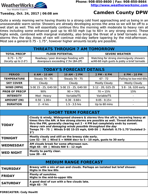
Quite a windy morning we’re having thanks to a strong cold front approaching and us being in an unseasonable warm sector. Showers are already developing across the area so we will be off to a wet start as well. This will essentially continue thru the morning with moderate to heavy rain at times including some enhanced gust up to 40-50 mph (up to 60+ in any strong storm). These highs winds, combined with marginal instability, also brings the threat of a brief tornado in any storms thru the day. Areas of rain will continue mid-day before tapering by the mid-afternoon. Most see a general 0.75 – 1.75″, however higher amounts locally are possible.